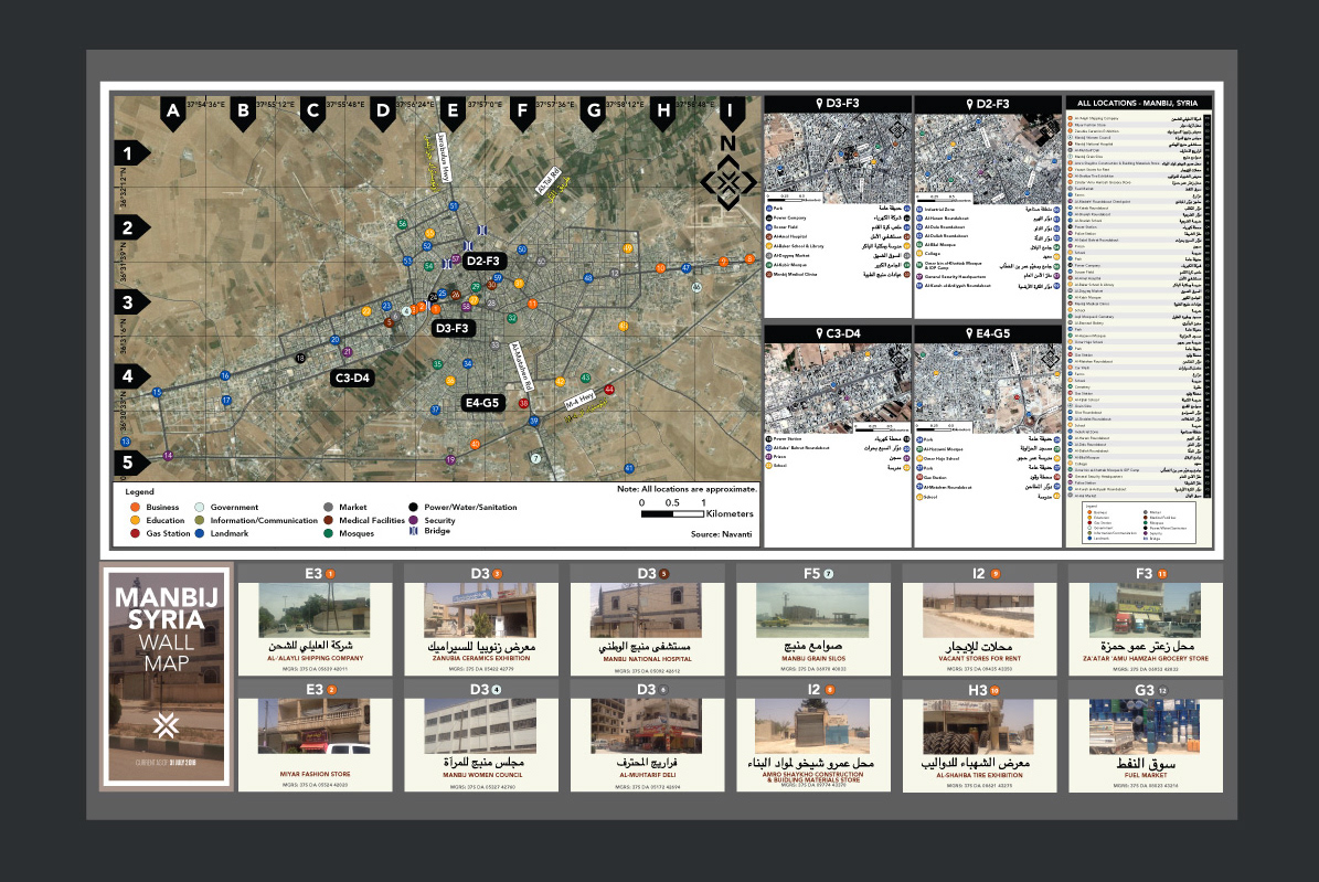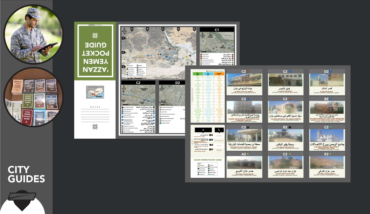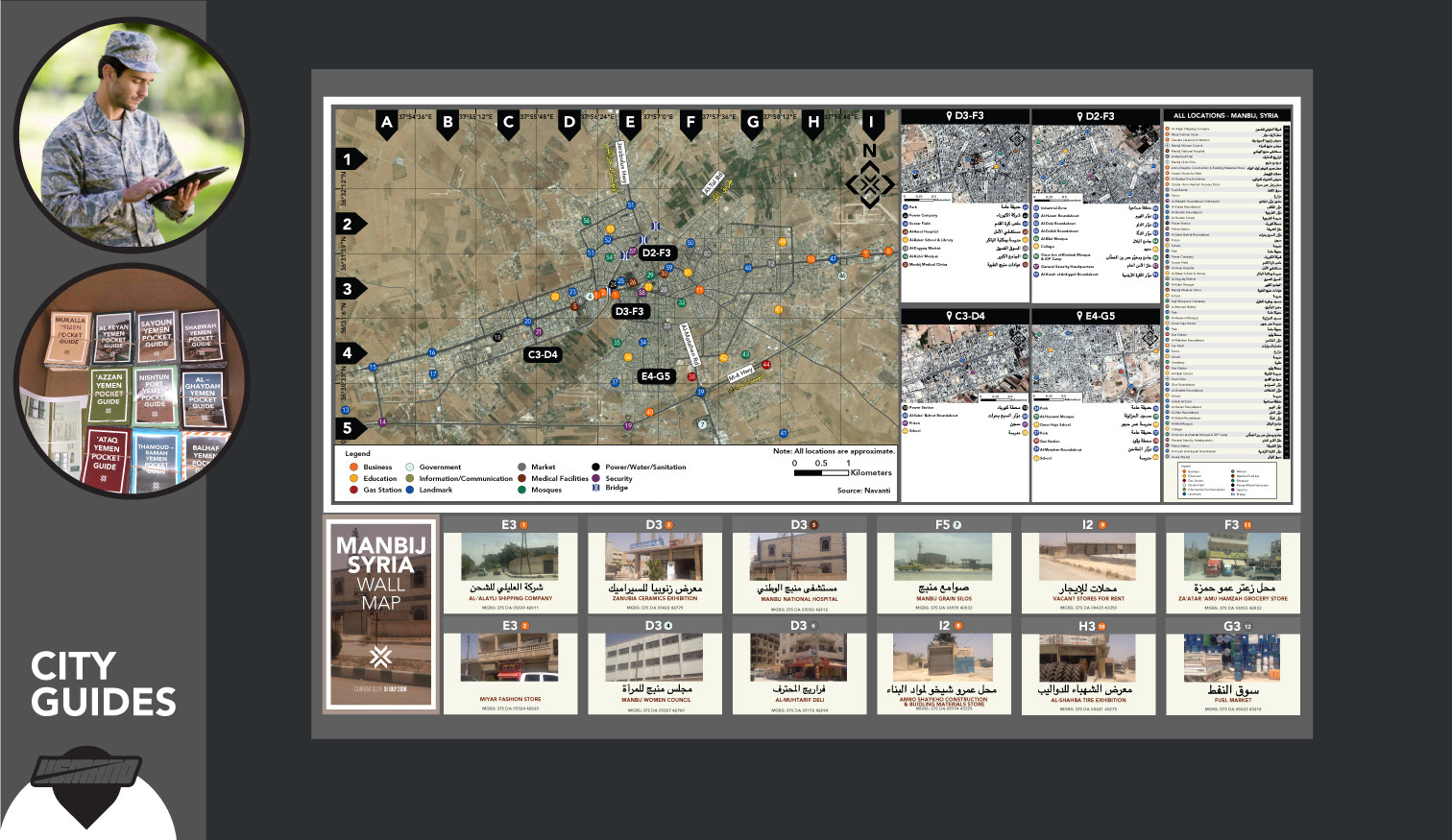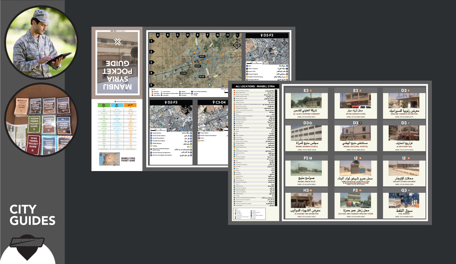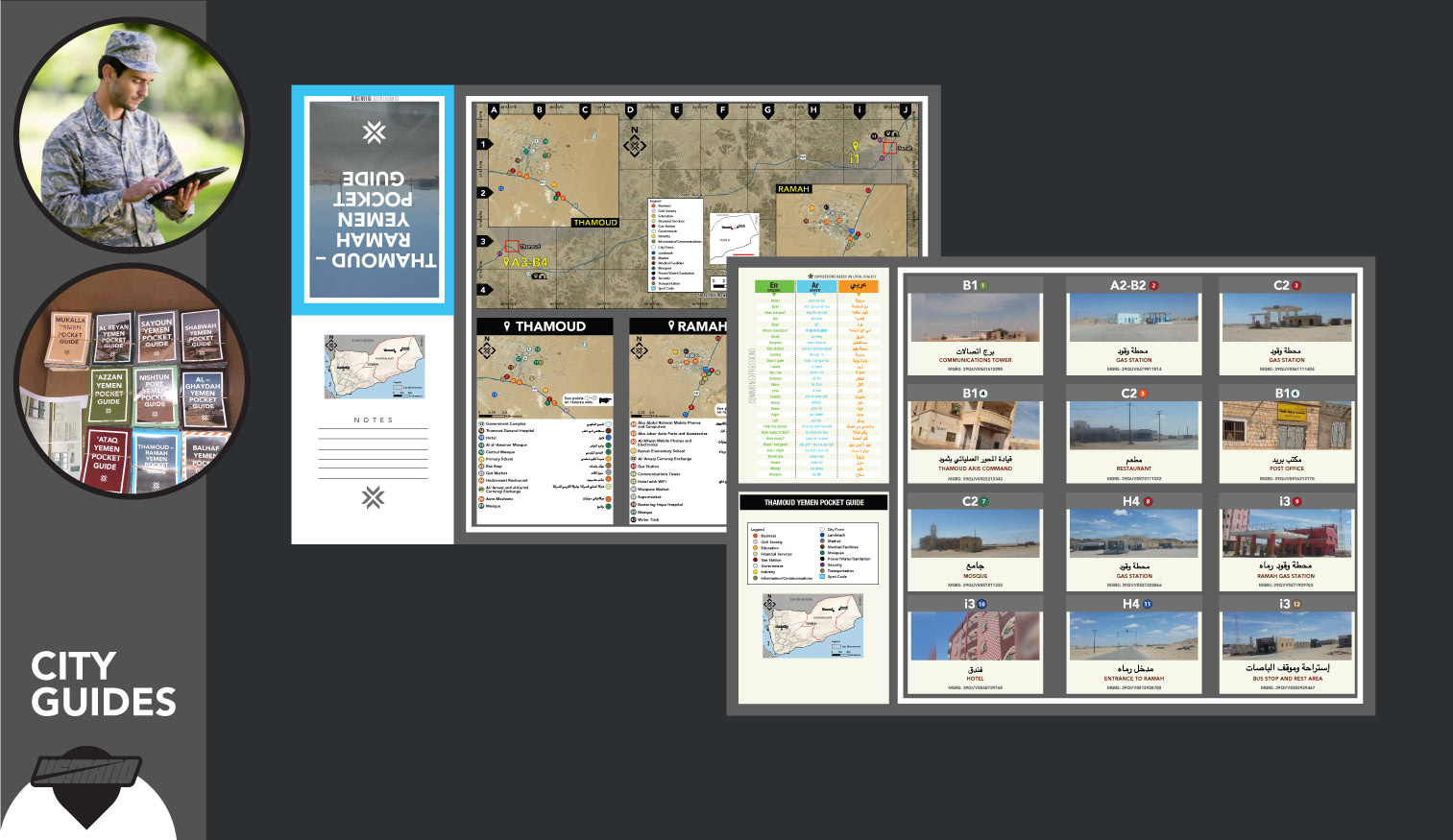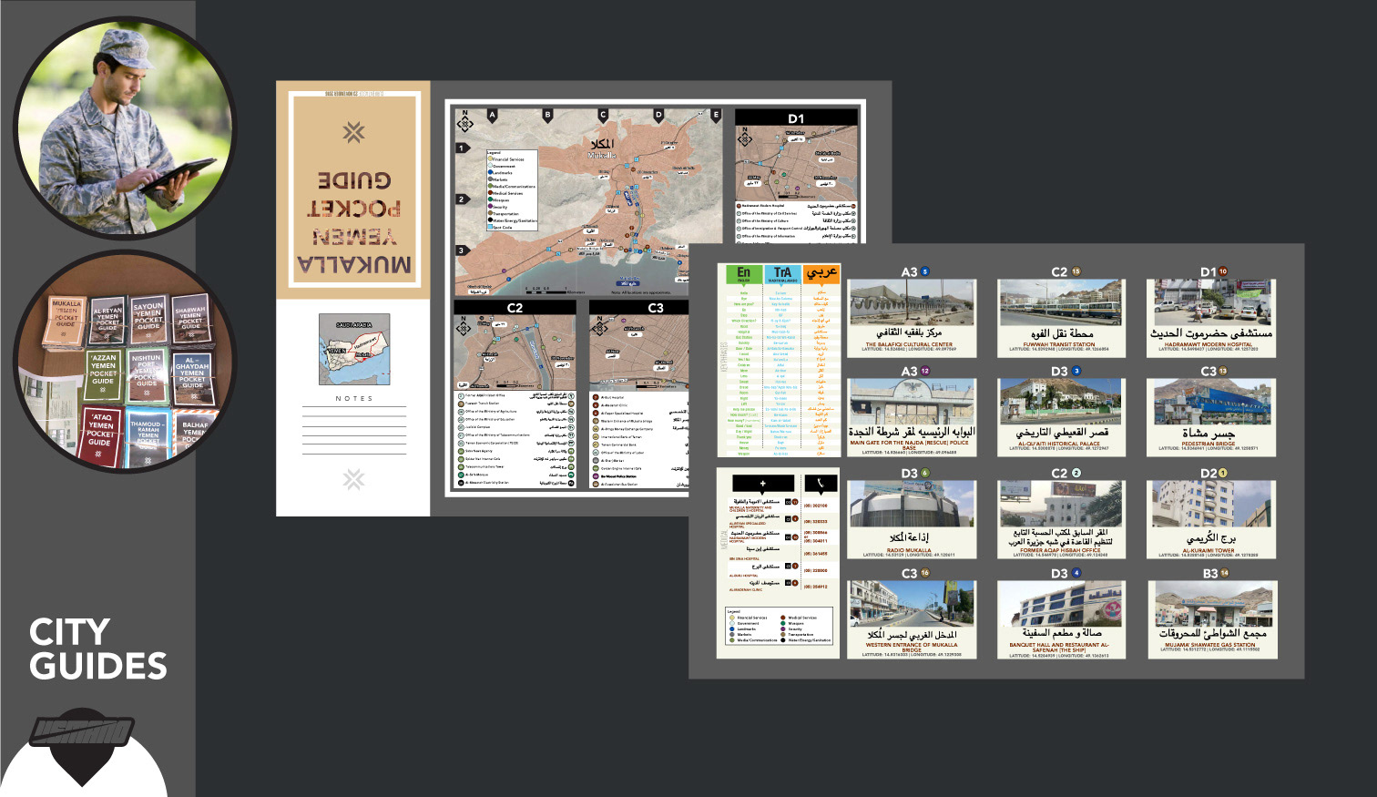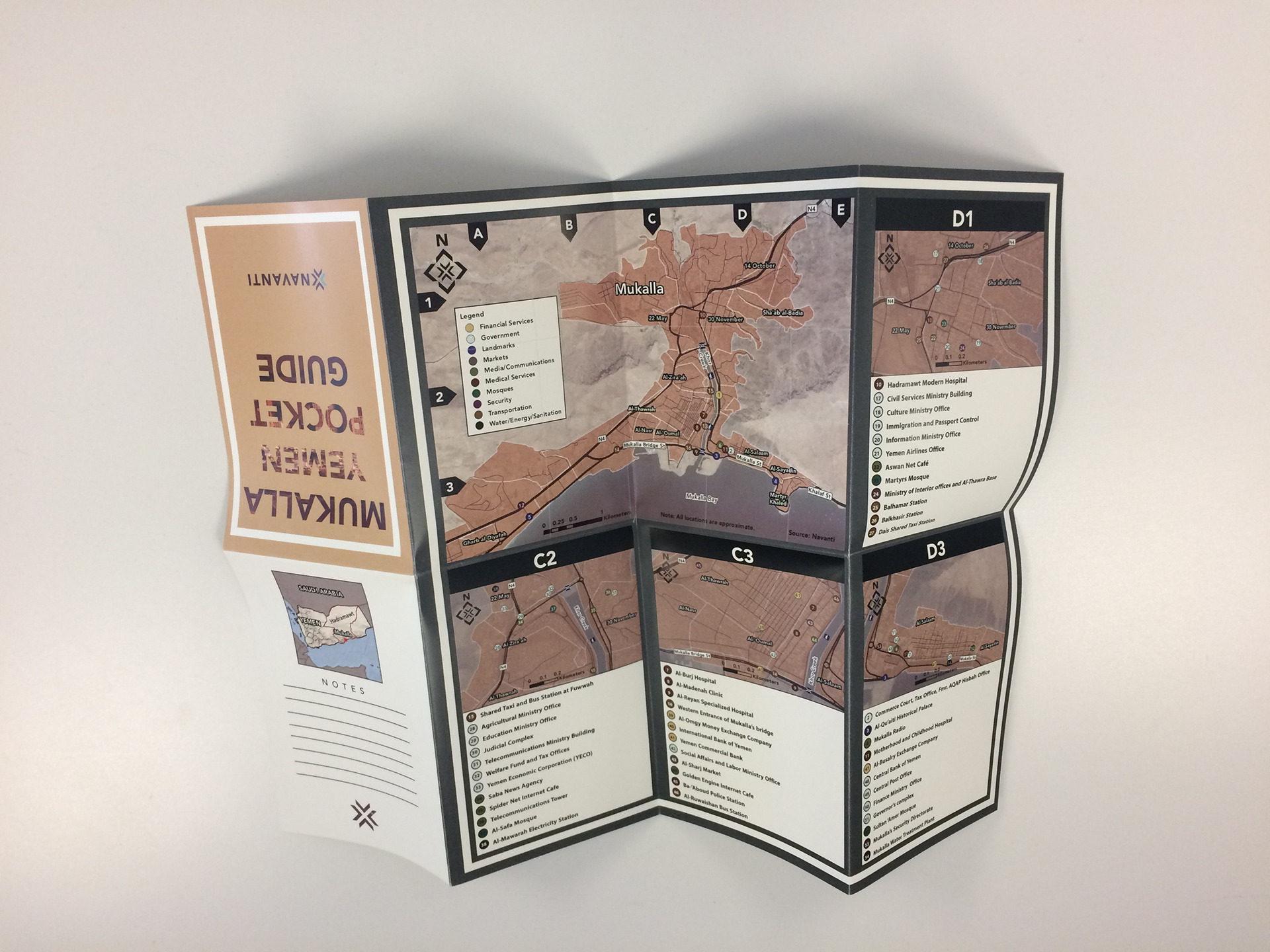
At Navanti Group, a research firm outside of Washington, DC, we convert complex datasets to accessible and digestible products using geospatial frameworks, perspectives from local contacts and expert analysis.
A popular product we created for our DoD customer was the city guides for troops and teams. I was responsible for collecting, sorting and visualizing data and images to convey an accurate assessment of complex operating environments around the world.
CONTENT HIGHLIGHTS